Landscapes of the Deep Sea
Bathymetry is the mapping of the seafloor.
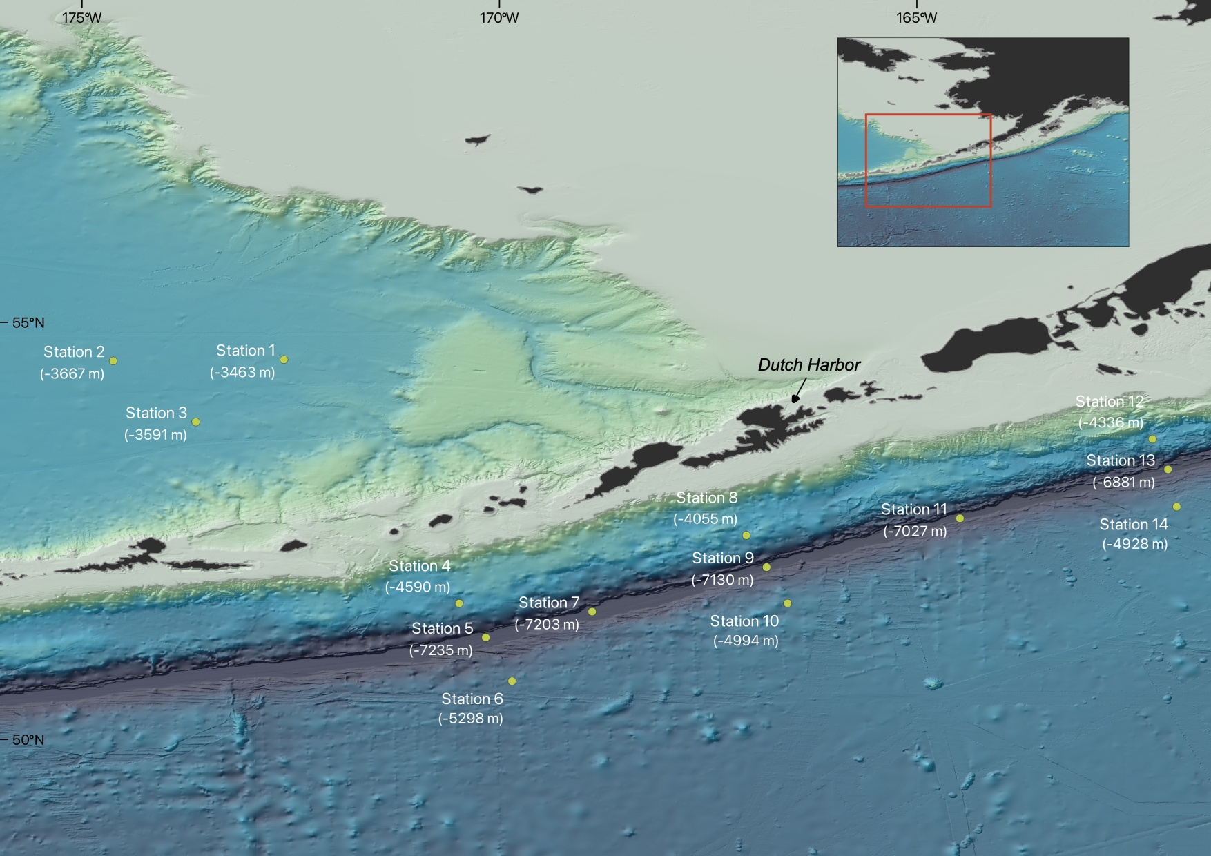
Just as mountains are surveyed on land, seafloor mappers survey seamounts, mid-ocean ridges, and deep-sea trenches below the ocean surface, such as the Aleutian Trench, which is the focus of the AleutBio expedition. The Aleutian Trench extends over 3000 km from Kamchatka in the west to the Gulf of Alaska in the east, with sediments burying the trench east of the Kodiak Islands off the southern coast of Alaska. In the nearly 8000 m deep trench it is cold, dark, and there is enormous pressure. It was formed in the Lower Cretaceous about 145 to 100 million years ago. Since then, the Pacific Plate has been sliding under the North American Plate and is melted in the Earth’s interior. The point where these two plates meet is the Aleutian Trench. The result of this so-called subduction is, among other things, the volcanic island arc of the Aleutian Islands, which is also part of the Pacific Ring of Fire, characterized by its volcanic activity and earthquake frequency.
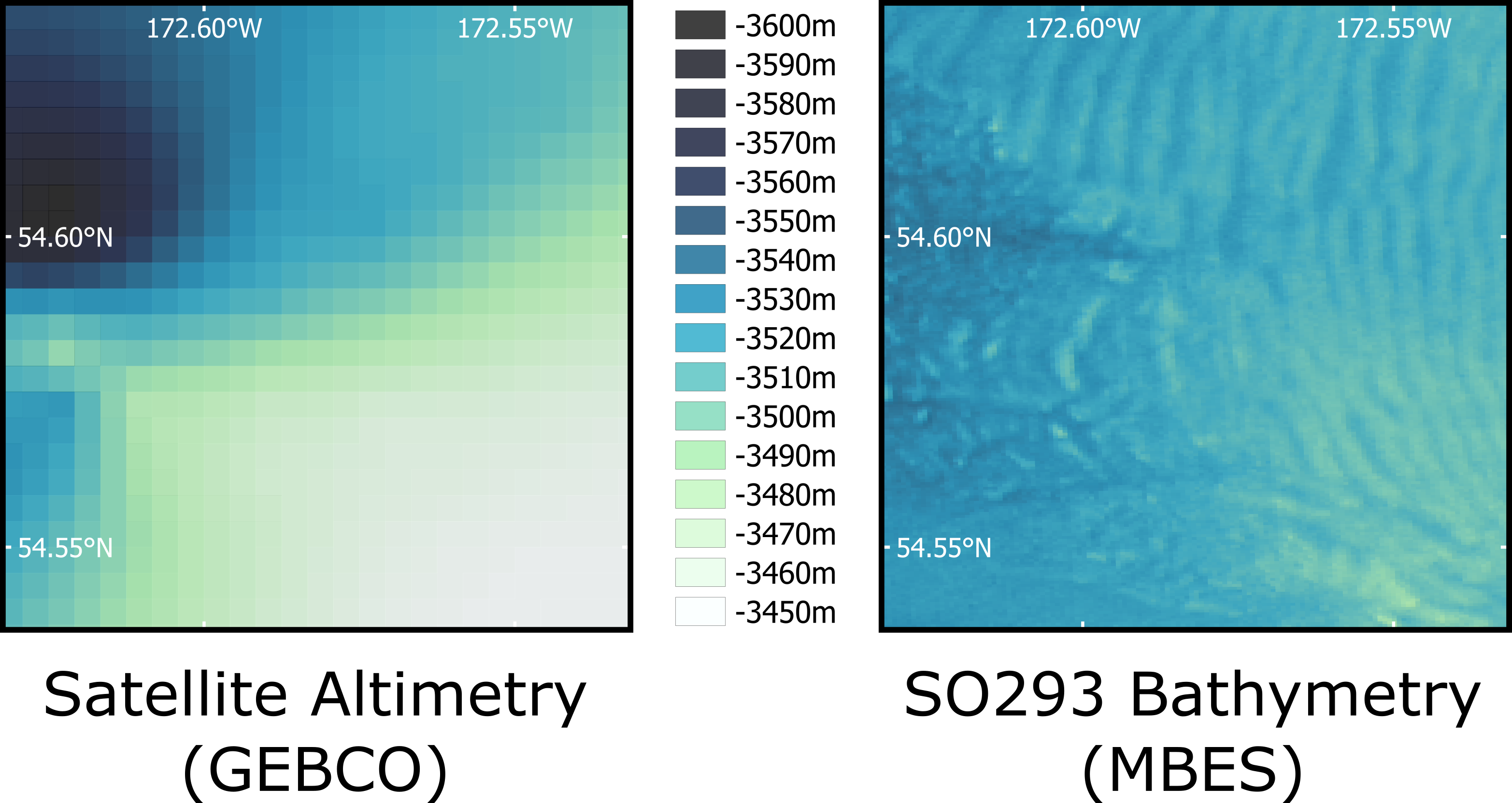
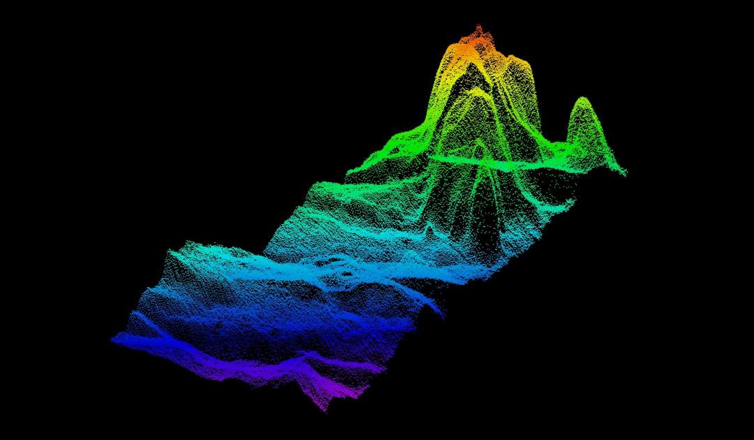
Few areas of our working area have been surveyed in detail to date, but this is not particularly surprising considering the fact that only about 20% of our planet’s seafloor has been mapped at high resolution. The remaining 80% of what we see on the seafloor comes from less accurate model calculations. To be fair, it should be added that in the early 20th century we were still surveying with a hand-held lead line. A lead weight was attached to a rope that had markings at specific intervals. When the lead line was lowered into the water, it was possible to read off the water depth from the markings as soon as it reached the bottom of the sea. A bathymetric map of the world compiled in 1903, called the GEBCO map, had just 18,000 data points. On our expedition, we get about 200,000 data points per hour, but no longer with a lead line. Today we survey with sound waves and multibeam echosounders. Multibeam echosounders are attached to the ship’s hull and emit a fan of sound towards the seafloor, where the sound is reflected and picked up again at a receiver. Based on the time span between the transmission and reception of the sound pulse, the water depth can be determined and three-dimensional models of the seafloor can be created.
During this expedition, the individual station areas will be mapped in high resolution with multibeam echosounders in order to determine the operational areas of the gear and, of course, to collect new data from previously unknown areas.